


Zoom Earth is a premier interactive weather map application that provides users with real-time satellite imagery and comprehensive weather data. The app's core functionality revolves around its ability to display near real-time weather conditions through high-definition satellite images, updated every 10-15 minutes from multiple geostationary and polar-orbiting satellites.
In addition to live satellite imagery, Zoom Earth offers advanced features like hurricane tracking, wildfire monitoring, and detailed weather forecast maps. Users can track the development of severe weather systems, monitor wildfires and smoke movement, and access various forecast parameters such as precipitation, wind speed, temperature, and atmospheric pressure. These capabilities make it an essential tool for weather enthusiasts, emergency responders, and anyone needing accurate weather information.
The application's value extends beyond casual weather observation, providing critical insights for outdoor planning and safety preparation. Its interactive interface allows users to customize their experience by adjusting temperature units, wind measurements, and animation styles, making it suitable for both professional meteorological analysis and personal weather monitoring.
Zoom Earth distinguishes itself through several remarkable features that enhance weather monitoring capabilities. The application's satellite imagery system stands out, utilizing data from NOAA GOES, JMA Himawari, and EUMETSAT Meteosat satellites for frequent updates, while NASA Aqua and Terra satellites provide twice-daily HD images.
The app's weather forecasting capabilities are equally impressive, offering multiple specialized maps that visualize different meteorological parameters. Users can access precipitation forecasts, wind speed and gust predictions, temperature variations including 'feels like' temperatures, relative humidity levels, dew point calculations, and atmospheric pressure patterns. Each forecast map draws from the latest DWD ICON and NOAA/NCEP/NWS GFS model data, ensuring accuracy and reliability.
Additional notable features include the hurricane tracking system, which follows tropical storms from formation to category 5 strength using data from NHC, JTWC, NRL, and IBTrACS. The wildfire tracking overlay, updated daily through NASA FIRMS, helps monitor active fires and heat spots. These sophisticated tools, combined with customizable settings and the premium Zoom Earth Pro subscription options, create a comprehensive weather monitoring solution that caters to both casual users and professionals requiring detailed meteorological analysis.
When it comes to weather applications, the accuracy of forecasts and the credibility of data sources are paramount. Zoom Earth excels in these areas by providing continually updated weather forecast maps with the latest model data from reputable sources like DWD ICON and NOAA/NCEP/NWS GFS.
The app offers a suite of forecast maps covering precipitation, wind speed and gusts, temperature, 'feels like' temperatures, wet bulb temperatures, relative humidity, dew point, and atmospheric pressure. This comprehensive approach ensures users receive a detailed outlook on impending weather conditions.
By sourcing its data from geostationary satellites such as NOAA GOES and JMA Himawari, and updating HD satellite images twice daily from NASA's polar-orbiting satellites Aqua and Terra, Zoom Earth guarantees that its satellite imagery is not only timely but also incredibly reliable.
Users benefit from this precision and reliability when planning their day-to-day activities or monitoring more severe weather patterns, ensuring they have trustworthy information at their fingertips.
A robust weather application must offer extensive temporal and spatial forecast ranges, and Zoom Earth rises to this challenge. The app provides an expansive view of global weather patterns through interactive maps that include rain, wind, temperature, pressure, and more.
With updates every 10 minutes from live satellites and detailed visualizations for different types of forecastsu2014such as hurricane tracking using the latest data from NHC, JTWC, NRL, and IBTrACSu2014Zoom Earth covers vast geographical areas with impressive frequency.
In addition to broad spatial coverage, the app delivers high-definition satellite images twice daily, giving users both macro and micro perspectives on weather movements. This dual capability allows for both immediate situational awareness and long-term planning.
Whether you're tracking wildfires with active fire overlays or observing cloud cover changes over time, Zoom Earth's wide-ranging forecast capabilities empower users to stay informed about environmental dynamics across various scales.
Real-time satellite imagery
Comprehensive weather data
Customizable interface
Advanced storm tracking
Global coverage
Premium features locked
Data delay present
Subscription required
Complex for beginners
Limited offline use

Accurate weather forecast and beautiful weather & clock widgets
 4.20
4.20
A powerful tool for ultimate weather awareness
3.50
Thermometer shows indoor and outdoor temperature
4.70
Ultimate Lunar Calendar for 2021!
4.80
NOAA radar, weather forecasts, hurricane tracking & customizable alerts.
4.50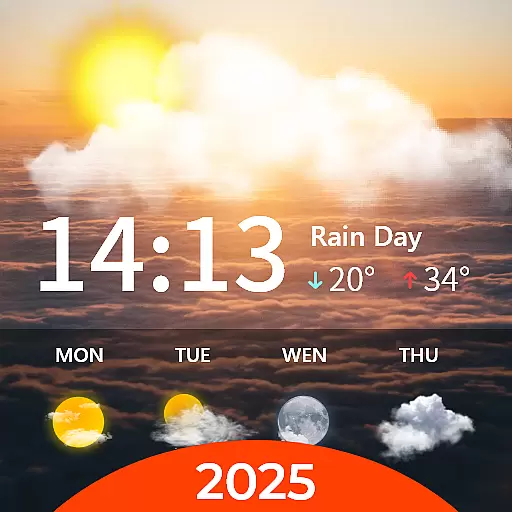
Your Personal Weather Assistant
4.00
Local Weather provides accurate and current hourly and daily forecasts.
4.80
NOAA forecast & radar for your exact location.
4.80
A powerful weather forecast to get real-time weather information
3.60
Live Weather Forecast app with acu weather radar, weather alert & weather widget
4.80
View weather widget and map. Wind direction and speed. Tides times and waves
4.70
Track lightning strikes with our thunderstorms map, radar and lightning alarm.
4.70
Get accurate rainfall and snowfall totals for pinpoint locations on a map.
4.60
Your ultimate app for accurate local weather information!
4.60
The most accurate weather app, hourly and daily weather, severe weather alerts
4.50
Accurate Weather App: various widgets, real-time storm radar, hurricane tracker.
4.50
Weather forecast & live radar map
4.20
Magnetic Compass meets smart tech: Get directions and weather alerts seamlessly
3.30
Retro TV-style digital watch face with weather, heart rate, steps & events!
4.0


User Reviews